 Geobru catalogue
Keyword
Brussels-Capital Region
Type of resources
Available actions
Topics
INSPIRE themes
Keywords
Contact for the resource
Provided by
Formats
Representation types
Update frequencies
status
From
1
-
2
/
2
-
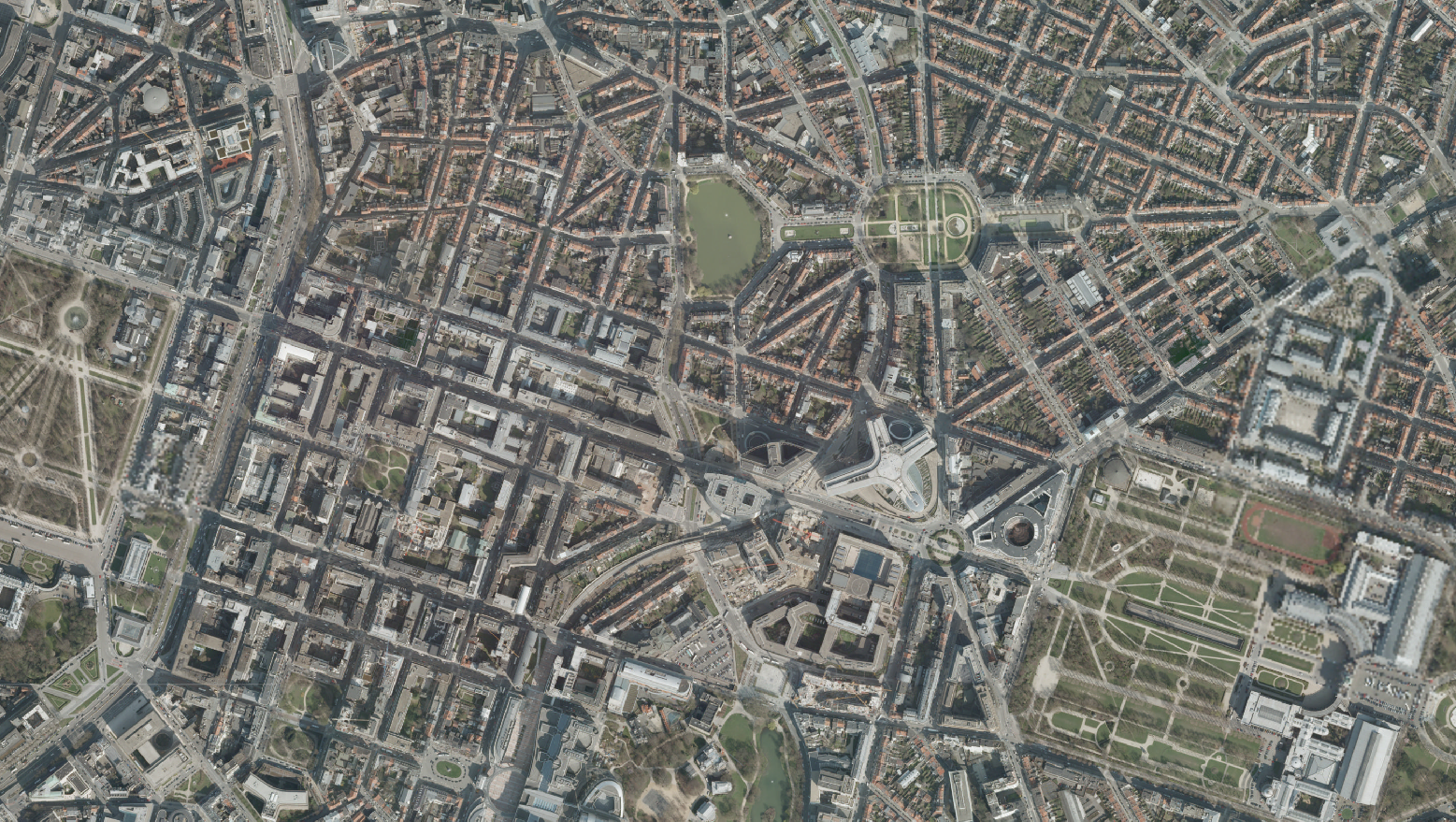
The orthophotos of the Brussels-Capital are made on the basis of large-scale aerial photographs. This orthophoto covers the whole territory of the region. Orthophotos available from 2009.
-
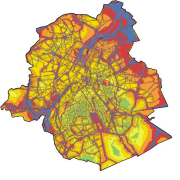
Brussels-Capital Region : The map combine multi-exposure Lden noise sources (road, tramway and metroplitan, rail and aircraft) and illustrate all modes of transportation combined, the overall annoyance during the week. The calculation method is to add the acoustic energy from different sources in a given point. The analysis of these maps is provided in the fact sheet n°47, available in French (https://document.environnement.brussels/opac_css/elecfile/Bruit%2047) and Dutch (https://document.environnement.brussels/opac_css/elecfile/Geluid%2047).